
Condition data is hard to use
Move from isolated survey sheets to road sections with location, condition, history and treatment information in one system.
Turn road condition into maintenance priorities and budget decisions.
A GIS-based pavement management environment for road inventory, condition surveys, condition indices, treatment planning, budget scenarios, deterioration trends and decision-ready reporting.
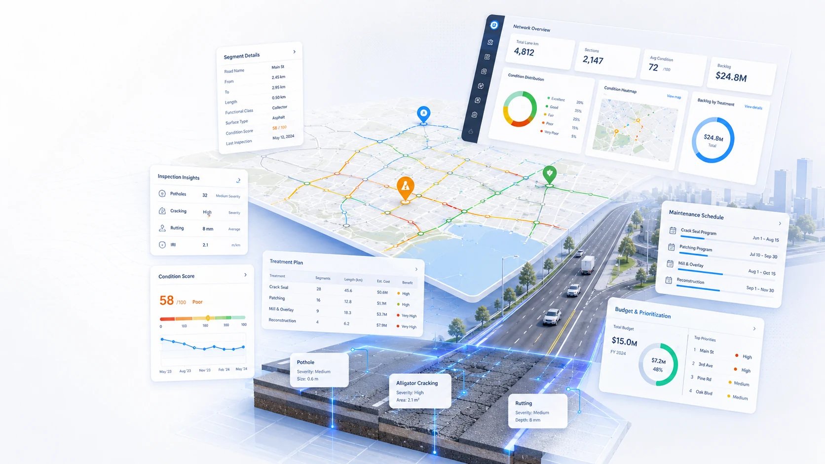
The system is designed around the decisions infrastructure teams need to make every day: what exists, where it is, what condition it is in, what requires attention and what happened next.
Move from isolated survey sheets to road sections with location, condition, history and treatment information in one system.
Test budget scenarios against real road needs and see what can be treated, deferred or left exposed.
Use consistent condition indices, treatment rules and prioritisation factors to support defensible maintenance programmes.
Modules can be adapted to the organisation's asset hierarchy, terminology, inspection methods, decision rules and reporting requirements.
Maintain road segments, geometry, hierarchy, surface information, dimensions and ownership in a mapped asset register.
Capture survey observations and pavement distress information against individual road segments and survey dates.
Store and report FCI, SCI and OCI values so pavement condition can be compared consistently across the network.
Define maintenance and rehabilitation treatments, unit costs, applicability and expected outcomes.
Create, edit and compare budget scenarios with status, funding amounts, selected treatments and resulting network impact.
Rank projects using condition, hierarchy, risk, cost and other client-defined decision rules.
Track historic condition and forecast how untreated road sections may change over future planning periods.
Generate road condition, treatment cost, budget, priority and trend reporting for technical and executive audiences.
Every module is designed to preserve the connection between the source evidence, the asset, the decision and the resulting work.
Build or import the road network and segment register.
Capture distress and condition against each segment.
Calculate or store condition indices and classifications.
Apply treatments, priorities and budget scenarios.
Publish maps, programmes, costs, trends and outcomes.
The platform can start with a focused use case and grow over time. The architecture separates field capture, structured data, GIS, business logic, integration and reporting so each part can evolve without turning the system into a monolith.
Responsive web interfaces, field forms, dashboards and reporting.
Business rules, workflows, authentication, integrations and automation.
Structured relational data, asset history, documents and audit records.
GIS geometry, network context, mapping, spatial queries and location intelligence.
Existing enterprise systems, IoT feeds, imports, exports and BI tools.
We can configure the asset model, GIS, workflows, database, integrations, dashboards and reporting around your organisation instead of forcing your processes into a generic template.